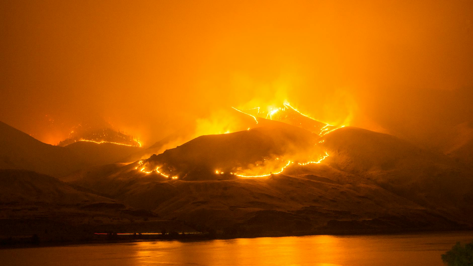
Considering the recent catastrophic wildfires in Los Angeles, which are still ongoing at the time of writing, I would like to start my detailed analysis of LEED v5 with a look at a new Sustainable Sites credit: Enhanced Resilient Site Design.
The credit’s intent is to “Reduce the risk of catastrophic impacts from natural and climate events…by designing, building, and maintaining sites to be more resilient to observed, projected, and future climate and natural hazards.” It requires protecting a project’s site and structures against at least two of the highest priority site-specific hazards identified in the Climate Resilience Assessment (IPp1): drought, extreme heat, flooding, hail, hurricanes and high winds, sea level rise, tsunami, wildfires and/or winter storms.
Thus, the credit contains several options to reflect the real dangers a project may face given its local climate, one of which is wildfire. In hot dry climates such as that of southern California, wildfire concerns shape the fate of developments at the wildland-urban interface and are of vital concern for planners and architects. In this post I will focus on the wildfire mitigation standards contained within the LEED v5 credit and then address the rest of the credit in a subsequent post.
The credit references three standards for wildfire mitigation: the National Wildfire Coordinating Group (NWCG) Standards for Mitigation, the SITES v2 Rating System Credit 4.11: Reduce the risk of catastrophic wildfire and the NFPA Firewise “Safer from the Start” Appendix E standard for fuel reduction, or requires following a local equivalent standard if available. The credit requires complying with standards for design of the wildland-urban interface, debris disposal, fire safety equipment, site and structure design and construction, and fuel reduction. These standards are worth looking at in detail; however, in this post I will provide an overview of the substantive strategies designers may employ to meet those standards and thus to protect projects against wildfire.
Causes of Structure Ignition
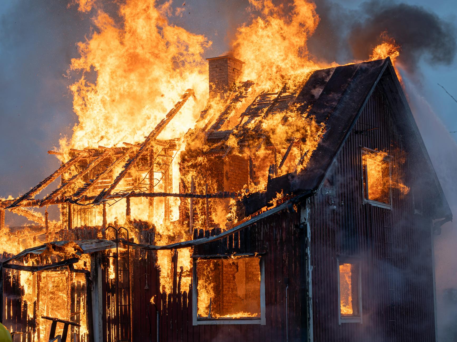
Why do structures catch fire and burn in wildfires? According the NFPA Firewise guide, structure ignition is usually caused by the worse-case combination of large amounts of vegetative fuel, hot, dry winds, and steep slopes, allowing the fire to quickly build in intensity. When hundreds of homes ignite almost simultaneously in a massive conflagration, it is very difficult or impossible for firefighters to effectively fight the fire. These conditions certainly seem to have been present in the Los Angeles fires in January 2025.
Unlike urban areas in which modern building codes have decreased the likelihood of massive destruction by fire, the wildland-urban interface, the transitional zone between unoccupied land and human development, presents significant challenges for fire resistance. Natural areas like forests are huge fuel loads, allowing wildfires to grow greatly in size and, especially in conjunction with high winds, to spread embers over a large area, igniting many structures.
Structures burn in wildfires due to their connection to the nearby environment. Breaking this connection by removing or reducing fuel in the structure ignition zone or “defensible space” (within 100-200 feet of a structure) is critical to protecting those structures; introducing regular fire breaks that reduce the intensity of the fire is key to protecting communities.
Environmental fire risk increases with the following factors:
- Type, arrangement and quantity of fuels: fine fuels (grass and pine needles) burn easily and quickly and ignite heavier fuels (trees), which burn longer and more intensely and generate a large volume of embers, giving the fire more chance to spread.
- Topography: fires burn up slopes more quickly than on flat ground, so mountain side/top communities are at more risk. Canyons act as wind channels, rapidly spreading fire.
- Climate and weather: dry, hot weather makes for ideally seasoned fuel; strong winds spread fire rapidly, beyond the capacity of firefighters to contain it.
Climate and weather are not factors designers have control over; planners can control risk by avoiding development on hillsides or in canyons, which are especially prone to fire, but these areas are often very scenic and desirable. However, designers and those who maintain structures and developments do have a great deal of control over the fuel load in the area surrounding a structure.
Once the fire has started, it can spread in three ways:
- Embers (burning needles, leaves, pinecones) land on combustible roofs and decks, or enter through vents or broken windows.
- Radiated heat from adjacent fires increases the temperature of combustible structures to their ignition point.
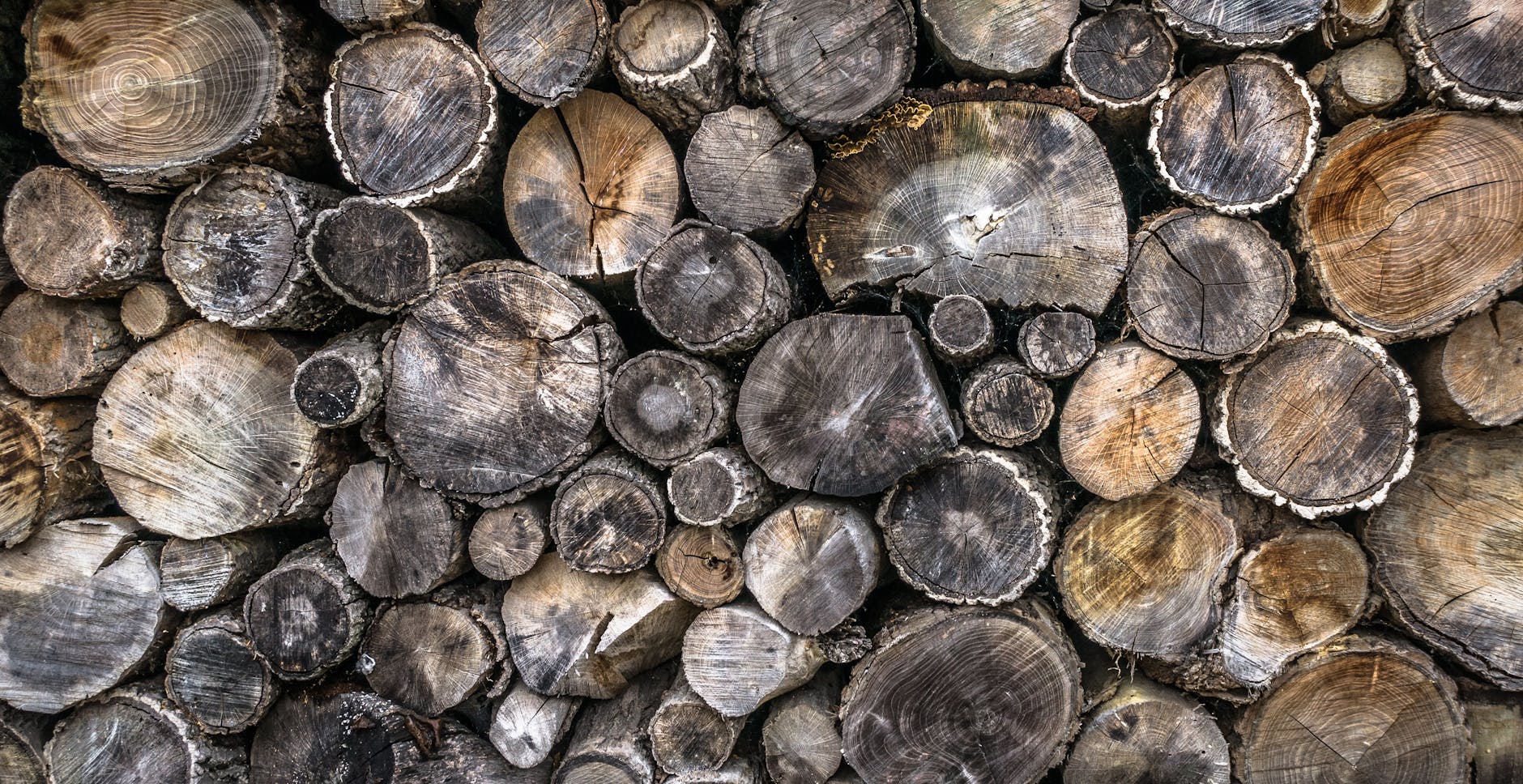
- Combustible fuels adjacent to structures (such as piles of pine needles or stacks of firewood) ignite and then ignite the structure.
These vectors vary in their impact due to distance from affected structures, so effective wildfire management requires a zoned approach to the area around a structure, balancing the need to reduce fuel sources with the ability of property owners and a community to perform necessary maintenance.
Zoned Fuel Reduction
Different organizations use different zone breakdowns. In the NWCG Standards for Mitigation, the area around structures is divided into three zones:
- Zone 1 (0-5 feet from the structure): the noncombustible immediate zone, most vulnerable to embers. Remove combustible materials from this zone to keep embers from igniting flammable materials near or in contact with the structure, including mulch, firewood, patio furniture and gas cans, as well as anything stored under decks. These areas should be hardscaped (paving, gravel).
- Zone 2 (5-30 feet): the immediate landscaped area. Remove fuels that support the growth of large, intense flames, so that the short flames that form will burn out when they get to Zone 1. Irrigate the area; mow grass and remove dead vegetation regularly. Use well-spaced, low-growing and low-combustible plantings. Do no keep boats, RVs and propane tanks in this zone.
- Zone 3 (30-100 feet, or up to 200 feet in areas with heavy fuel loads or slopes): reduce fuel continuity so that large, intense flames cannot persist, converting to low-intensity flames in Zone 2. Remove dead leaves and other dead vegetation; space groupings of trees far apart; provide outbuildings with their own managed ignition zones.
- Beyond Zone 3: reduce ember production by thinning forests of smaller trees and high-flammability species. Use strategic fire breaks (water bodies, golf courses, roads, farmland) and make them accessible to firefighters.
NFPA Firewise standards combine Zones 1 and 2 but substantially similar recommendations. Again, the overall goal is to reduce the load of fuel in proximity to structures.
Fire-Resistant Structures
In addition to fuel load reduction, these standards also recommend increasing the fire-resistance of structures themselves. The greatest danger to structures is wind-born embers, usually burning leaves or needles, which fall onto roofs or are sucked into vents or other openings.
According to the NWGC Standards for Mitigation, structures in fire-prone areas should:
- Avoid re-entrant corners where embers can accumulate and ignite the structure. Keep these areas clear of debris like dead leaves and needles and protect with metal flashing.
- Seal openings around windows, doors and other envelope penetrations; protect laundry, attic and soffit vents with fine non-combustible, non-corroding metal mesh to keep out embers.
- Use tempered glass and screens to protect windows and doors; use tempered glass skylights rather than plastic.
- Use steeper sloped roofs to discourage embers from accumulating.
- Use non-combustible gutters and keep the gutters clear of debris.
- Repair damaged shingles or tiles; seal any gaps; seal the roof edge with metal flashing to prevent ember intrusion between roofing material and roof deck.
- Install non-combustible skirting around decks; do not store anything below the deck.
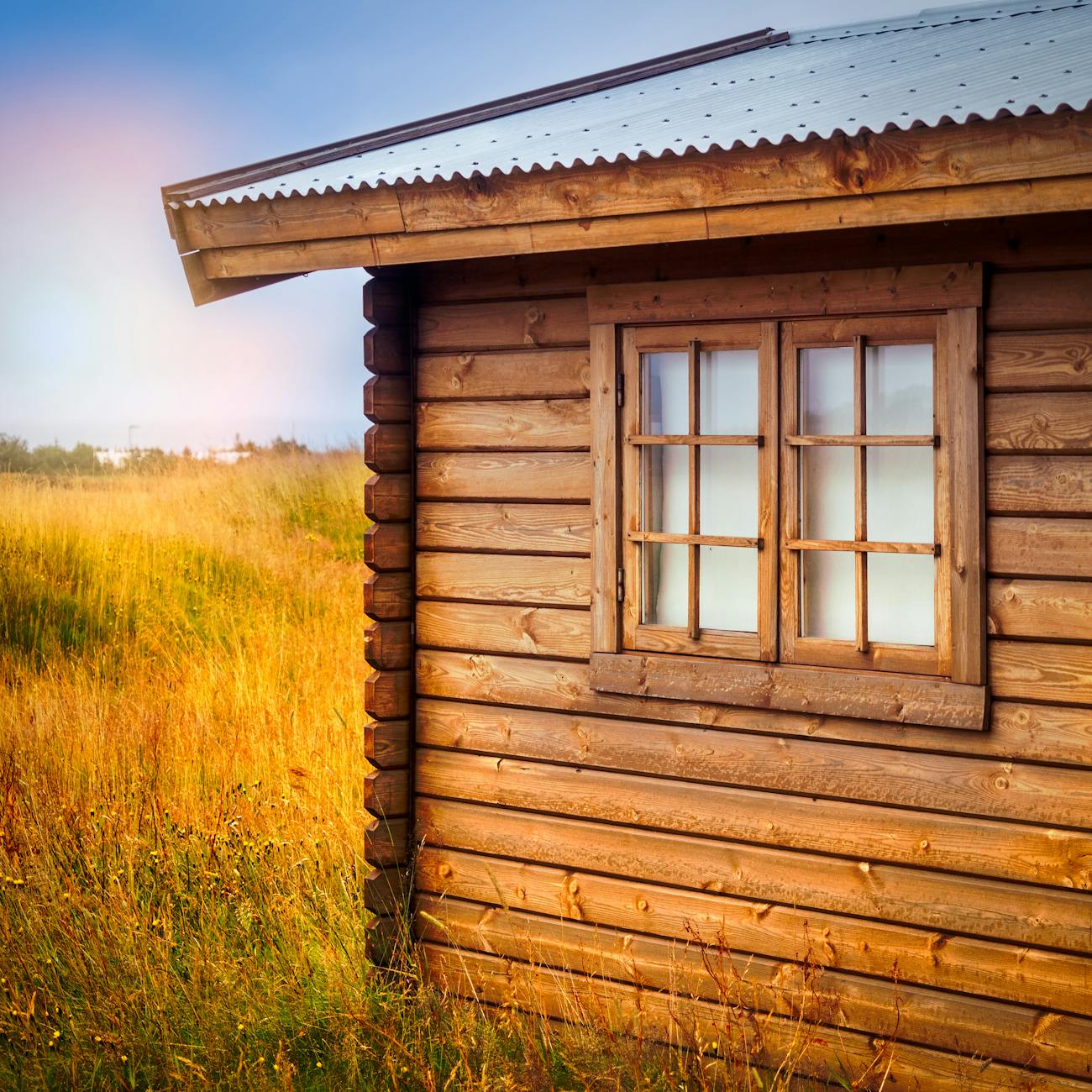
- Use non-combustible siding materials (metal, cement board) or fire-retardant treatments; use non-combustible roof materials; use heavy timber deck or porch structures with fire-retardant treatment.
- Apply the same standards to outbuildings as are applied to the main building.
Unfortunately, the ideal second home in the wooded hills, with its cedar siding, cedar shingled roof, complex quaint geometries, wide spreading deck and big windows facing a vista across the canyon is the antithesis of these standards and stands little chance of surviving in the event of a wildfire. Structures in wildfire-prone areas don’t have to concrete bunkers; however, some ingenuity is required on the part of designers to incorporate these standards into architecture and urban planning.
Given the increasing likelihood of hot, dry weather in areas like southern California due to climate change, new developments and rebuilding efforts following disasters like the LA wildfires must bake wildfire resilience measures into their DNA. Like other sustainable and resilience measures, wildfire resilience measures work best when adopted holistically, rather than piecemeal, requiring an integrated approach to design involving the collaboration of a diverse range of professionals and stakeholders, and a careful appraisal of local conditions.
Thanks for reading! Please like this post if you enjoyed the content, comment if you have any questions, and consider subscribing to this blog for future posts.
Resources
Information on the LEED v5 for New Construction – Sustainable Sites Credit – Enhanced Resilient Site Design can be found here.
Information on the SITES v2 Credit 4.11: Reduce the risk of catastrophic wildfire can be found here (this is an overview of the SITES rating system, including a description C4.11).
NFPA wildfire protection information can be found here. The NFPA has many relevant standards regarding wildfire mitigation: see especially NFPA 1144.
The NWCG Standards for Mitigation in the Wildland Urban Interface (PMS 052) can be found here.

Leave a comment